

In the golden window for emergency rescue, across the vast airspace of security patrols, and within the complex environments of engineering surveying, are traditional operational models becoming your constraint? Redundant equipment limiting mobility, cumbersome procedures delaying response, data processing lagging behind decision-making needs…
ICE CYPRESS addresses these industry pain points with a systematic solution through technological innovation. The Hunter Wing: Single-Operator UAV Mapping & Recognition System is officially launched!
A lightweight UAV operation platform that deeply integrates “real-time 3D reconstruction, AI intelligent recognition, and high-precision spatial positioning” to redefine the boundaries of operational efficiency with minimal deployment.
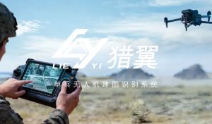
Ultra-Lightweight Design
The Hunter Wing system adopts a modular integrated architecture. The core intelligent computing module and power unit weigh <600 grams combined, approximately 1/5 the weight of traditional solutions.
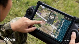
It allows for agile movement in mountain rescue, flexible deployment for reservoir patrols, and unhindered operation in complex terrains without equipment burden. A single operator can manage the entire workflow, achieving a “one person, one drone, full-area reach” operational model.

High Compatibility & Easy Deployment
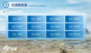
The system offers deep compatibility with the full range of DJI enterprise-grade UAV models, including the M4E, M4T, M300, and more, requiring no hardware modifications or custom development. The operation process is simple: power on, connect, launch mission. Even beginners can get started quickly, significantly reducing training costs and deployment cycles.
Four Core Capabilities
The Hunter Wing system boasts four core capabilities: Real-Time Mapping, Ultra-Fast Recognition, Precise Positioning and Data Flow & Integration.
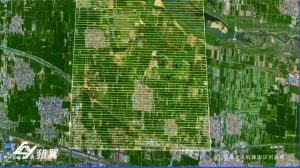
During flight, the system simultaneously generates high-precision orthomosaic images and real-scene 3D models. Complete scene data is output immediately upon mission completion, significantly enhancing survey efficiency.
Equipped with multi-category object detection algorithms, it supports customized recognition of personnel, vehicles, hazard points, etc., with a recognition response time under 0.5 seconds. It automatically outputs key information like target count, category, and confidence level.
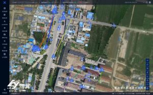
The system acquires precise geographic coordinates of targets in real time, overlaying them on orthomosaic images, supporting location traceability and verification. This meets the high-precision positioning needs of rescue, security, and monitoring scenarios.
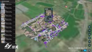
Imagery, recognition results, and positioning data are transmitted to the ground station in real time. Results support one-click cloud upload, and data can be exported in multiple formats for subsequent analysis, archiving, and reporting.
All-Scenario Applications
Emergency Rescue:
In disaster sites like earthquakes or floods, the system can rapidly complete 3D modeling. Its AI identifies trapped individuals and survivor locations, providing minute-level spatial intelligence to support command decisions.
Security Patrols:
For facilities, borders, or large event airspaces, the system conducts 3D patrols, identifies suspicious persons or vehicles in real time, automatically marks their locations, and triggers alerts.
Environmental Monitoring:
Over rivers, reservoirs, or mining areas, the system creates area-wide maps, intelligently identifying targets like drainage outlets, waste accumulation, and vegetation damage, building a digital foundation for environmental supervision.
Engineering Surveying:
At construction sites, the system performs real-time 3D reconstruction, quickly obtaining terrain data to support visual progress control and digital inspection/acceptance.






