

The ability to understand and interpret physical environments is becoming increasingly important as industries accelerate digital transformation. From smart cities and infrastructure management to emergency response and low-altitude applications, organizations need more than traditional mapping tools. They require intelligent systems that can analyze complex spaces and generate valuable insights.
At Icecypress Technology, we are advancing the future of visual spatial intelligence by combining artificial intelligence, 3D technologies, drone photogrammetry, and low-altitude data processing. As a spatial intelligence AI company specializing in 3D and AI, we build independent core technologies that change raw visual information into actionable intelligence. Our solutions help industries create stronger digital foundations and unlock new opportunities in the growing low-altitude economy.
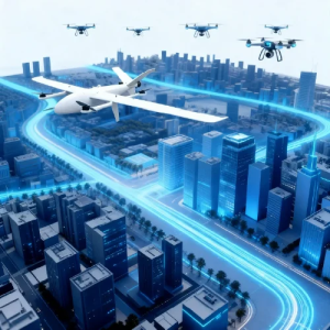
What Is Visual Spatial Intelligence and Why Does It Matter?
Visual spatial intelligence refers to the ability of intelligent systems to understand, analyze, and interact with physical spaces through visual data. Unlike traditional image recognition technologies that focus mainly on identifying objects, visual spatial intelligence focuses on understanding relationships between objects, locations, environments, and changes over time.
This capability combines computer vision, artificial intelligence, 3D reconstruction, and geospatial technologies. By processing images, point clouds, and other spatial information, AI systems can create detailed digital representations of real-world environments.
For modern industries, this technology provides a new way to manage complex operations. Instead of relying only on manual inspections or static geographic information, organizations can use intelligent spatial models to monitor conditions, predict risks, and make faster decisions.
At Icecypress Technology, we believe visual spatial intelligence is a key technology for connecting the physical world with digital intelligence. By developing 3D AI capabilities, we help businesses move from simple data collection toward intelligent understanding and operational improvement.
How Does Visual Spatial Intelligence Work with 3D AI?
The foundation of visual spatial intelligence is the ability to convert real-world environments into accurate digital models. This process typically involves several important technologies working together.
First, drone photogrammetry provides efficient aerial data collection. Drones can capture high-resolution images across large areas, creating a detailed information source for further processing. Compared with traditional surveying methods, drone-based data acquisition offers greater flexibility and improved efficiency.
Next, AI algorithms analyze collected visual information and reconstruct three-dimensional environments. Through 3D modeling technologies, aerial images can become digital twins, point clouds, and realistic spatial models.
The final stage involves intelligent analysis. Instead of providing users with large amounts of unprocessed data, visual spatial intelligence systems identify meaningful patterns, detect changes, and generate insights that support decision-making.
At Icecypress Technology, we combine these capabilities into an integrated pipeline. Our approach connects low-altitude data, drone photogrammetry, and 3D + AI technologies to deliver complete geospatial intelligence solutions.
How Spatial Intelligence Solutions Support Industry Digital Upgrade
As industries become more data-driven, businesses require reliable technologies that can improve efficiency and reduce operational uncertainty. This is where spatial intelligence solutions provide significant value.
Infrastructure companies can use intelligent 3D models to monitor construction progress, inspect assets, and identify potential problems. Urban management teams can create digital environments to support planning and resource management. Emergency response organizations can quickly understand complex locations through real-time spatial analysis.
We develop spatial intelligence solutions designed to address these practical industry challenges. Our technologies help organizations transform low-altitude aerial data into decision-ready intelligence.
Our DroneSwarm Real-Time Onboard Analysis System supports multi-UAV collaboration and real-time reconstruction through intelligent computing capabilities. Our TrackSight High-Speed Target Tracking & Analytics System provides advanced target analysis and tracking functions for dynamic environments.
In addition, our Rusa Rapid 3D Scene High-Fidelity Reconstruction System and Mirauge3D Automatic 3D Modeling System enable efficient 3D scene generation and large-scale digital modeling. These solutions provide the technical foundation required for industries adopting digital twins and intelligent management platforms.
From Raw Imagery to Actionable Intelligence
Many geospatial platforms focus mainly on collecting and displaying information. However, collecting data is only the first step. The real value comes from understanding that data and applying it to real-world decisions.
At Icecypress Technology, we focus on creating a complete visual spatial intelligence pipeline. We combine data acquisition, 3D reconstruction, AI analysis, and application solutions into one integrated system.
Our technology helps organizations overcome the challenge of managing large amounts of aerial data. Instead of manually reviewing images or interpreting complicated geographic information, users can access intelligent analysis results that support faster responses.
This transformation is especially important for the development of the low-altitude economy. As drone applications expand globally, industries need safer and smarter ways to manage low-altitude environments. Our solutions help create the digital infrastructure needed for efficient low-altitude operations.
The Future of Visual Spatial Intelligence in the Low-Altitude Economy
The rapid growth of drones and autonomous systems is creating new possibilities for industrial applications. However, successful adoption requires more than cutting edge hardware. It requires intelligent systems that can understand environments and support automated decision-making.
We are committed to strengthening the digital foundation behind this transformation. Through continuous innovation in 3D AI and spatial intelligence technologies, we help industries improve safety, efficiency, and intelligence.
Our independent technologies enable localized breakthroughs while supporting global applications. By integrating visual data with artificial intelligence, we are helping organizations build smarter workflows and develop new possibilities within the low-altitude economy.
Building a Smarter Digital World with Icecypress Technology
Visual spatial intelligence represents a major step forward in how industries understand and interact with the physical world. By combining 3D reconstruction, AI analysis, and geospatial intelligence, this technology creates a bridge between real environments and digital decision-making.
At Icecypress Technology, we continue to develop innovative spatial intelligence solutions that turn raw imagery into actionable intelligence. Our mission is to make low-altitude space more efficient, secure, and intelligent through end-to-end 3D AI technologies.
As industries continue their digital transformation journey, we will keep advancing visual spatial intelligence and creating new opportunities for smarter industrial development worldwide.






