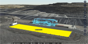
Open-pit mines rarely stay still. Excavation reshapes working areas, equipment moves between locations, stockpile volumes change, and slope conditions require continued attention. Monthly or quarterly surveys can document the site, but their information may already be outdated when teams receive it.
A mining digital twin helps close this gap by keeping spatial and operational information connected over time.
This guide explains how a mining digital twin supports open pit mining teams in mine safety, production monitoring, and planning—and which capabilities make it useful alongside mine planning software.
What Is a Mining Digital Twin in Open-Pit Operations?
Closing the gap between survey data and current site conditions starts with understanding what this technology represents beyond a 3D model.
Define a Mining Digital Twin
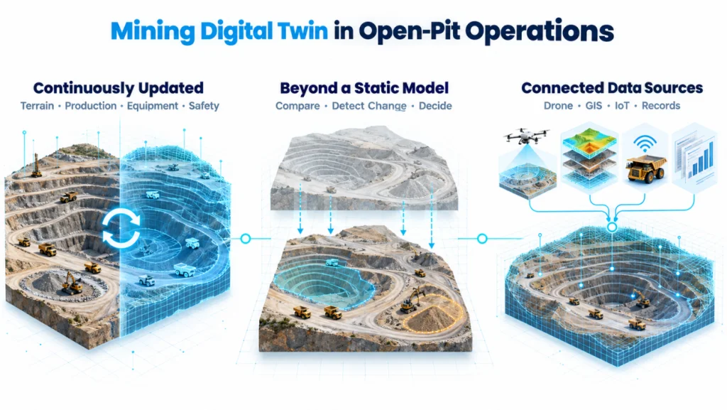
A mining digital twin is an updated digital representation of mine terrain and available operational data. Survey updates and connected equipment, production, and monitoring records help teams review site conditions; freshness depends on each data source.
More Than a Static 3D Mine Model
A static map records site geometry at one point in time and gradually becomes less representative as mining progresses. A digital twin connects successive updates with operational information, allowing teams to compare conditions, identify change, and use the model in continuing decisions.
One View Built from Multiple Data Sources
Drone surveying and drone mapping update the spatial foundation, while GIS adds geographic and design context. Where integrated, IoT feeds, equipment information, and production records add operational context. Bringing these sources together gives survey, production, and planning teams a more consistent view.
Why Traditional Mine Monitoring Methods Struggle in Open-Pit Operations
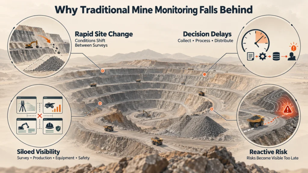
The difference between a static model and an operational digital twin becomes most visible in day-to-day mine management. Traditional monitoring methods can produce accurate information, but they often struggle to keep that information current and connected as operations continue.
· Rapidly Changing Site Conditions
Excavation, earthmoving, and stockpile changes continue between monthly or quarterly surveys. A completed terrain model may therefore reflect earlier rather than current conditions.
· Delayed Operational Decisions
Field collection is followed by processing, checking, and distribution. When this cycle takes too long, mine safety reviews and production adjustments may rely on outdated information.
· Siloed Operational Visibility
Survey, production, equipment, and safety teams may work with different systems and update schedules. When essential data remains separated, teams cannot maintain a reliable site-wide view, even when mining management software is already in use.
· Reactive Risk Management
Disconnected information makes it harder to relate terrain change to nearby vehicle or production activity. Risks may become clear only after they affect operations, leaving planning teams and mine planning software with incomplete inputs.
Practical Applications of the IceCypress Digital Twin Mine Solution
These limitations cannot be resolved simply by collecting more data. The real improvement comes when updated information becomes part of the decisions mine teams make, which is where the IceCypress Digital Twin Mine Solution fits into the operational workflow.
· Open-pit Mine Safety
Drone collection and Mirauge3D support repeated 3D model updates. Comparing model sections with design profiles supports slope change monitoring and review. Where integrated, defined operating boundaries and vehicle-position data add context on truck and bulldozer activity. Model comparisons do not replace dedicated geotechnical monitoring or expert assessment.
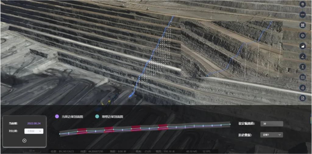
Together, these capabilities give mine safety teams a more current view of terrain and vehicle activity, supporting earlier operational adjustments when conditions change.
· Production Monitoring
The platform supports area, volume, and length measurements of pits and stockpiles. Multi-phase drone imagery helps teams compare material-volume changes. Applying representative bulk-density parameters to measured volumes can estimate material mass; results depend on survey quality and density assumptions.
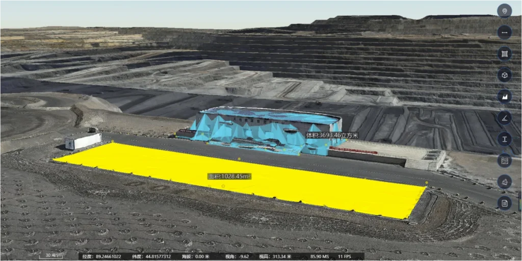
This allows production teams to review material changes across survey periods and use survey estimates alongside production records for reconciliation and reporting.
· Production Planning
Updated measurements and available production records support capacity estimation and resource scheduling. Where connected equipment systems provide status or estimated arrival times, these inputs can support fleet coordination; availability and freshness depend on those integrations.
This gives mine planning software more current inputs for resource allocation across open pit mining operations.
Building Safer, Better-Connected Open-Pit Operations
A mining digital twin is most valuable when it connects changing site conditions with decisions that can still influence the work. It gives survey, production, equipment, and safety teams a shared operational view instead of leaving information in separate workflows.
IceCypress applies its expertise in 3D reconstruction and spatial intelligence to turn changing mine conditions into a shared operational picture. By connecting spatial data with safety, production, equipment, and planning workflows, the solution helps mines move from fragmented, reactive management toward more coordinated and informed operations.
Explore how IceCypress can tailor a mining digital twin solution to your mine data, operational priorities, and existing systems.
Frequently Asked Questions
1. What is a mining digital twin?
A mining digital twin is an updated digital representation of mine terrain and available operational data. It brings survey updates and connected operational records into a shared environment, with update frequency determined by the source data.
2. How is a mining digital twin different from a 3D mine model?
A 3D model primarily represents site geometry captured at one point in time. A digital twin adds updated survey and operational data, allowing teams to use the same environment for continued monitoring, comparison, and decision-making.
3. Can a mining digital twin improve open pit mining safety?
It can provide more current information for assessing risk. Model-to-design comparison supports slope change monitoring and review. Integrated position data and defined operating boundaries can add visibility of vehicle activity. These inputs support safety reviews alongside dedicated monitoring and established site procedures.
4. How does drone mapping support stockpile measurement and production planning?
Repeat drone mapping creates datasets for comparison. Teams can measure stockpile area and volume, review changes, and use representative bulk-density parameters to estimate material mass. These estimates support planning and production reconciliation, with accuracy dependent on survey quality, comparability, and density assumptions.