As drone mapping projects expand across larger areas and multiple flights, maintaining consistent accuracy, stable processing, and reliable outputs becomes increasingly challenging. Aerial triangulation can fail or produce disconnected blocks, 3D models may become distorted or incomplete, and processing bottlenecks can leave teams with unusable outputs.
Fixing these issues may require repeated processing or additional field capture. Designed for large-scale photogrammetry, ICE CYPRESS Mirauge3D combines aerial triangulation, 3D reconstruction, point cloud processing, and orthomosaic production in a unified workflow.
This article examines common failures in large-scale projects and explains how to avoid them.
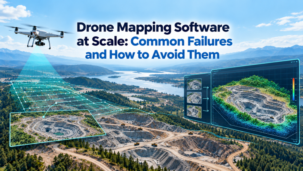
Why Drone Mapping Projects Become More Difficult at Scale
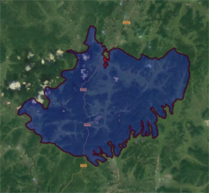
At scale, drone mapping software must handle larger image blocks, multiple flights, difficult terrain, and wide-area quality checks. As image blocks expand, inconsistencies in image geometry, camera positioning, and feature matching become harder to identify and correct.
- Larger datasets: More images create more matching and adjustment work while increasing computing, memory, and storage requirements.
- Multiple flights: Differences in lighting, shadows, camera settings, and scene conditions can make images harder to match consistently across flight blocks.
- Complex scenes: Steep terrain, weak textures, and reflective surfaces can reduce reliable matches or create gaps in reconstructed surfaces.
- Geometric consistency: Maintaining alignment and checking results across a large area is harder when small errors can accumulate or go unnoticed.
For large-scale drone mapping, capture quality, project settings, and software capacity jointly shape results. Software can help balance some visual differences, but it cannot recover missing image detail or fully compensate for inconsistent capture conditions.
5 Common Drone Mapping Software Failures and How to Prevent Them
Large-scale drone mapping is a chain of dependent processing stages. Image alignment and camera adjustment, 3D reconstruction, point-cloud generation and classification, and orthomosaic production can each introduce errors that carry into later outputs. The following sections examine these failure points, their causes, and ways to address them.
1. Aerial Triangulation Fails or Becomes Fragmented
- Common symptoms: Unmatched images, disconnected blocks, incorrect camera positions, or image blocks that fail to adjust.
- Main causes: Insufficient overlap, blurred imagery, weak textures, narrow survey geometry, poorly distributed control points where required, or inconsistent coordinates.
- How to solve or prevent it: Inspect source imagery; verify coordinate systems and camera parameters.Where ground control is required, distribute control points across the survey area and verify their coordinate accuracy before adjustment. Before drone mapping software proceeds to dense reconstruction, review tie-point coverage, block connections, camera positions, and adjustment residuals.
2. 3D Models Become Fractured, Layered, Bent, or Incomplete
- Common symptoms: Broken surfaces, vertical offsets, curved terrain, mismatched block edges, or missing geometry.
- Main causes: Accumulated alignment errors, unstable adjustment, insufficient viewing angles, or weak image matching.
- How to solve or prevent it: Strengthen cross-strip connections, check adjustment residuals, and adapt matching to the scene. Add oblique imagery for façades or steep terrain; integrate LiDAR or other spatial data when imagery cannot capture complete geometry.
3. Processing Becomes Too Slow or Stops
- Common symptoms: Excessive processing time, memory shortages, software crashes, or repeated project splitting.
- Main causes: Massive image volumes, redundant data, inefficient bundle adjustment, or insufficient computing resources.
- How to solve or prevent it: Remove unusable or redundant images, estimate resource needs, and test representative data first. Use parallel or distributed processing for large datasets where available.
4. Point Clouds Contain Noise, Gaps, or Classification Errors
- Common symptoms: Incomplete surfaces, excessive noise, mixed ground and vegetation points, or unreliable terrain outputs.
- Main causes: Poor source imagery, occlusion, weak textures, unsuitable dense-matching settings, or limited classification.
- How to solve or prevent it: Adapt matching settings to the scene and improve capture angles where possible. During point cloud processing, use automated point cloud classification, manually refine critical areas where needed, and validate the results before generating DEMs or measurements.
5. Orthomosaics Show Seams, Distortion, or Color Differences
- Common symptoms: Visible image boundaries, displaced buildings, inconsistent brightness, or abrupt color changes.
- Main causes: Parallax, terrain variation, changing light conditions, or unsuitable seamline placement.
- How to solve or prevent it: Use a suitable DSM-based or true-orthophoto workflow, optimize seamlines, balance image brightness and color, and manually review complex building areas.
How to Prevent Failures in Large-Scale Drone Mapping
For large-scale projects, drone mapping software should support consistent inputs, staged quality checks, and resource planning before errors reach final outputs.
1. Standardize data across flights
Maintain consistent camera and coordinate settings across flights, minimize unnecessary exposure variations, and record changes in capture conditions.
2. Plan ground control and checkpoints
Distribute ground control points across the survey and use independent checkpoints to verify accuracy throughout the project. Avoid placing control points along a single line in corridor surveys.
3. Test before full processing
Test a representative subset covering challenging terrain, weak-texture areas, and boundaries between flight blocks before processing the full dataset. Use the results to refine settings and resource estimates before processing the full dataset.
4. Check quality at key stages
Review image alignment, camera positions, and adjustment residuals before dense reconstruction. Inspect models, point clouds, and orthomosaics before export so errors can be traced and corrected before delivery.
5. Choose reliable drone mapping software
Evaluate software based on aerial triangulation stability, dataset capacity, processing efficiency, quality-control tools, and support for the required output formats.
ICE CYPRESS Mirauge3D for Large-Scale Drone Mapping
Preventing these failures requires drone mapping software that can carry a large image block through aerial triangulation, reconstruction, point cloud processing, and orthomosaic production. ICE CYPRESS’s Mirauge3D Automatic Image 3D Modeling System brings these capabilities into one workflow for large-scale projects.
Aerial triangulation
Mirauge3D combines parallel free-network adjustment, GPU-accelerated bundle adjustment, and GPS-assisted sparse-control-point adjustment to improve processing efficiency and stability across large, complex image blocks. These options support adjustment of large or complex image blocks when control points are sparse.
Large-scale processing
Mirauge3D supports multi-engine processing on a single workstation and Redis-based collaboration across multiple nodes, allowing teams to manage large-scale workloads more flexibly.
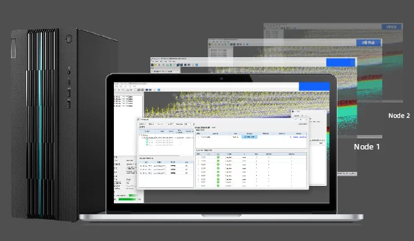
Multi-engine processing on a single workstation
3D reconstruction
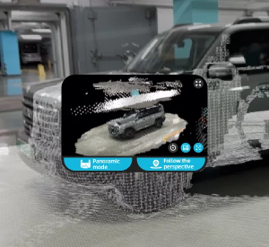
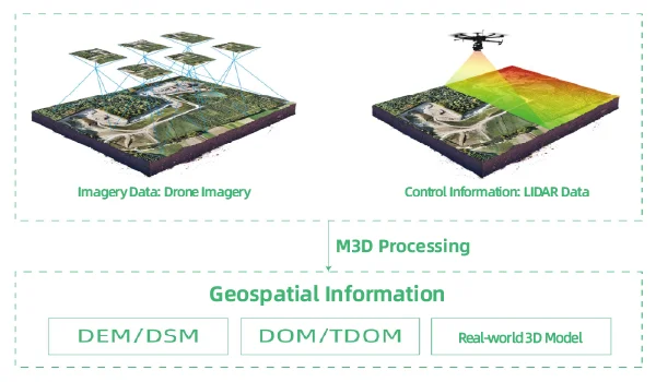
Joint reconstruction from LiDAR point clouds and multi-view imagery supports more complete geometry. Adaptive dense matching addresses weak-texture areas, while mesh optimization helps preserve surface detail.
Point-cloud processing
Automatic and supervised classification, editing tools, TIN viewing, and DEM export help teams classify and refine point clouds for terrain workflows.
Orthomosaic production
Seamline optimization can route joins around buildings and abrupt color transitions, while interactive editing allows manual refinement. Brightness and color balancing help reduce visible mosaic artifacts. DOM, TDOM, and DSM are supported outputs.
From Project Checks to Delivery
Reliable large-scale mapping depends on consistent flight data, well-distributed control, representative tests, and quality checks before processing moves to the next stage. For teams handling extensive imagery and multiple deliverables, Mirauge3D brings aerial triangulation, distributed processing, LiDAR-supported reconstruction, point-cloud tools, and orthomosaic outputs into one production system.
ICE CYPRESS also includes technical assistance, software updates, and documentation in standard post-purchase support, with dedicated service options available to enterprise clients. If issues arise during alignment, processing, or output production, teams can contact ICE CYPRESS for troubleshooting guidance.
Contact ICE CYPRESS to discuss your project requirements.