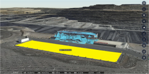
Choosing between LiDAR and photogrammetry depends on the required accuracy, site conditions, texture needs, available capture equipment, and processing workflow. These requirements determine which method can deliver the geometry, visual detail, and measurements the project needs.
For projects using field video, ICE CYPRESS’s Rusa extracts frames from the footage to reconstruct measurable 3D scene models without dedicated laser-scanning hardware. This LiDAR vs photogrammetry comparison examines the two methods’ working principles, key differences, and applications to help teams select a workflow suited to their capture and measurement needs.
What Is LiDAR?
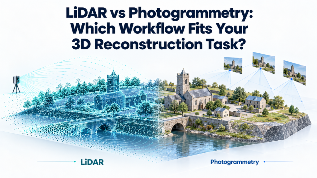
LiDAR, or Light Detection and Ranging, measures distances directly using laser pulses. Combining range measurements with sensor position and orientation produces a point cloud representing geometry, distances, and elevations.
Common LiDAR Types
Common types include terrestrial LiDAR for stationary ground scanning, mobile LiDAR for capture from moving platforms, and aerial LiDAR for coverage from aircraft or UAVs.
LiDAR Advantages and Limitations
A key advantage of LiDAR is direct geometric measurement without relying on visual feature matching. It can operate without daylight and may capture ground returns through vegetation gaps.
However, blocked sightlines, dense vegetation, weather, and registration requirements affect results; laser measurements alone do not provide photographic textures. Rain and dense haze can obstruct airborne collection, while multiple scan positions help address coverage gaps at complex sites.
What Is Photogrammetry?
Photogrammetry derives three-dimensional geometry from overlapping photographs or video frames captured from different viewpoints. Software matches visible features, estimates camera positions, and reconstructs surfaces. With suitable scale and control, outputs include a point cloud, mesh, textured model, and measurable scene.
Photogrammetry Data Sources
Data sources include ground cameras, UAV imagery, and field video. Image-based 3D reconstruction combines spatial geometry with recorded surface appearance, supporting documentation and visual inspection. Capturing an object from multiple angles also helps document surfaces hidden in a single image.
Photogrammetry Advantages and Limitations
The LiDAR vs photogrammetry tradeoff involves image quality as well as hardware. Photogrammetry supports flexible capture and detailed textures, but insufficient overlap, blur, poor lighting, or featureless surfaces can create gaps and errors.
LiDAR vs Photogrammetry: Key Differences
The LiDAR vs photogrammetry comparison starts with how measurements are obtained. Both methods can produce spatial models, but their inputs and dependencies differ.
| Comparison | LiDAR | Photogrammetry |
| Working principle | Direct laser ranging | Geometry inferred from overlapping images |
| Capture equipment | Laser scanner; positioning equipment where required | Cameras, UAV cameras, or video devices |
| Input data | Laser returns and position/orientation data | Overlapping photographs or extracted frames |
| Primary outputs | Spatial coordinates, elevation models, derived surfaces | Spatial coordinates, elevation models, textured meshes, and orthomosaics |
| Point cloud generation | Coordinates calculated from measured ranges | Coordinates calculated through image matching |
| Color and texture information | Added through associated imagery | Derived from source imagery |
| Dependence on visible light | Laser ranging operates without daylight | Images require suitable illumination |
Accuracy
In LiDAR vs photogrammetry, LiDAR obtains geometry through direct ranging, making measurements less dependent on image detail.
Photogrammetry derives point cloud geometry from matched features, making accuracy more sensitive to image resolution, camera calibration, and viewing angles. With suitable imagery, camera calibration, and spatial control, photogrammetry can achieve high accuracy for appropriate applications.
Environmental Adaptability
LiDAR operates without daylight and can reach ground through canopy gaps; specular surfaces can produce missing or misleading returns.
Photogrammetry needs sufficient natural or artificial illumination and distinctive features. Dark, featureless, reflective, or moving surfaces can impair matching, limiting reliable reconstruction.
End-to-End Workflow
LiDAR workflows filter measured geometry and register scans when needed. Textured models additionally require camera imagery aligned with the scans. Image-based 3D reconstruction calculates geometry through image alignment and matching, then uses those same images for texturing.
LiDAR vs Photogrammetry: How to Choose the Right Workflow
Choose your reconstruction workflow based on project deliverables, site conditions, and available capture equipment.
Choose LiDAR When
- You need bare-earth elevations for drainage design or terrain planning on vegetated sites, where canopy gaps allow ground returns.
- You need building or infrastructure measurements where weak lighting or featureless surfaces make photographic matching unreliable.
Request sample results from comparable field conditions.
Choose Photogrammetry When
- You need 3D scene reconstruction preserving colors and surface details for heritage records, construction progress reviews, or incident documentation.
- You want image-based 3D reconstruction using available cameras or field video.
Require adequate lighting, overlapping views, and validated measurement accuracy.
Combine LiDAR and Photogrammetry When
- You need ground elevations beneath vegetation alongside photographic detail of visible structures.
- You need laser-surveyed geometry and textured surfacesin one as-built model.
Require a shared coordinate system and verified alignment.
Rusa for Rapid Image-Based 3D Reconstruction
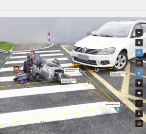
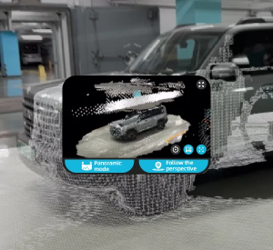
Teams choosing between LiDAR and photogrammetry may consider video capture when they need textured records and measurements of visible scenes, and can obtain clear, overlapping views. ICE CYPRESS’s RUSA uses video captured with supported devices as the source for 3D scene reconstruction, extracting frames from the footage to build measurable 3D models. For traffic accident scenes, these models support measurement and incident review; for engineering sites, they support progress documentation and dimensional checks.
Flexible Capture and Rapid Reconstruction
Capture uses supported cameras or mobile devices without dedicated surveying hardware. Adaptive frame extraction adjusts to capture speed and scene conditions. Previews support coverage checks in minutes; detailed reconstruction takes as little as 40 minutes.
High-Fidelity Scene Measurement
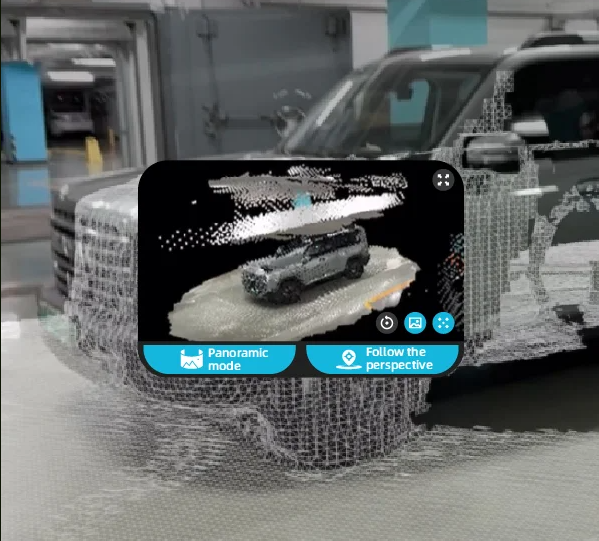
The viewer provides detailed textures and interactive analysis. RUSA supports measurement errors below 2 cm under specified conditions, with tools for length, area, volume, true distance, horizontal distance, and multi-point measurement.
AI-Assisted Review and Output
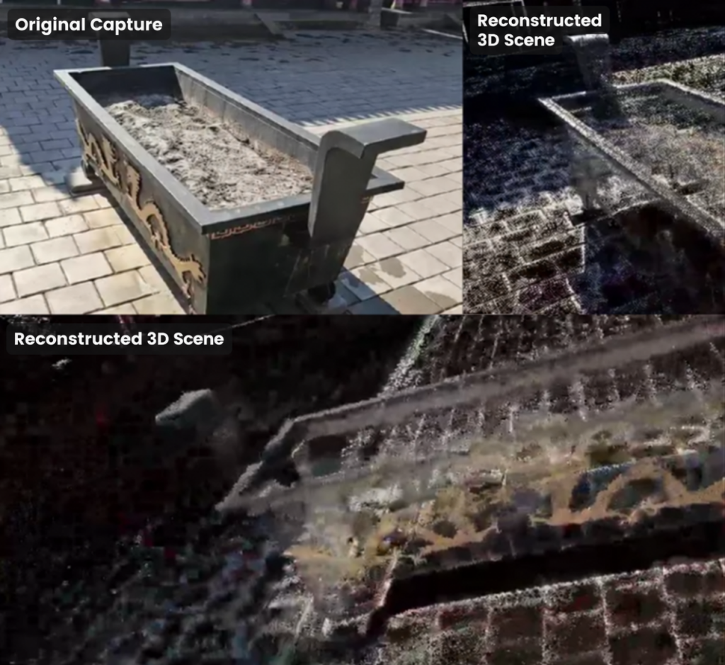
AI-assisted detection highlights supported elements, including tires, obstacles, traffic signs, and road damage. Users can hide irrelevant features, annotate measurements, generate custom reports, and use multi-format exports.
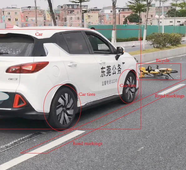
Find the Right Reconstruction Workflow
An image-based workflow is worth considering when teams need textured, measurable scene records and can record clear video with overlapping views. For traffic accident reconstruction or engineering site documentation, teams can evaluate Rusa using representative field video, checking the resulting 3D model’s scene coverage, visual detail, and measurement accuracy against project requirements.
Review Rusa’s applications and discuss your capture conditions and required outputs with ICE CYPRESS.
References
- National Oceanic and Atmospheric Administration. What Is Lidar?
https://oceanservice.noaa.gov/facts/lidar.html
- National Oceanic and Atmospheric Administration. Lidar 101: An Introduction to Lidar Technology, Data, and Applications.
https://coast.noaa.gov/data/digitalcoast/pdf/lidar-101.pdf
- S. Geological Survey. Creating 3D Point Clouds, Digital Elevation Models, and Orthomosaics From Historical Aerial Imagery Through Structure From Motion Aided Photogrammetry.
https://pubs.usgs.gov/publication/tm11C11/full
- S. Geological Survey. Camera System Considerations for Geomorphic Applications of SfM Photogrammetry.
https://www.usgs.gov/publications/camera-system-considerations-geomorphic-applications-sfm-photogrammetry
- Nielsen, M. S., et al. Quantifying the Influence of Surface Texture and Shape on Structure from Motion 3D Reconstructions.
https://www.mdpi.com/1424-8220/23/1/178
- Rusa Rapid 3D Scene Reconstruction System.
- National Institute of Standards and Technology. Calibration Experiments of a Laser Scanner. NISTIR 6922.
https://www.nist.gov/publications/calibration-experiments-laser-scanner
- Burdziakowski, P., and Bobkowska, K. UAV Photogrammetry under Poor Lighting Conditions—Accuracy Considerations. Sensors, 21(10), 3531.
https://www.mdpi.com/1424-8220/21/10/3531