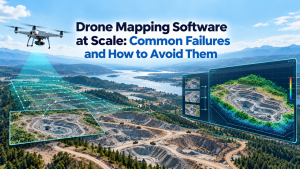
Geographic data now comes from satellites, drones, GNSS receivers, sensors, surveys, and GIS databases. For organizations managing land, infrastructure, or natural resources, simply displaying these datasets on a map is no longer enough. We need methods that reveal patterns, relationships, changes, and risks across space. This is the practical value of spatial analysis in geography, especially when 3D reconstruction and AI can turn location-based data into operational insight.
Understanding What Spatial Analysis Really Does
Spatial analysis examines geographic relationships rather than treating features as isolated records. We can ask where something occurs, how close it is to another feature, whether a pattern is concentrated, and how conditions vary across an area. Modern GIS platforms support operations such as proximity analysis, spatial overlays, density analysis, terrain modeling, and statistical analysis.
The method should follow the business or governance question. A buffer can identify areas within a defined distance of roads or rivers. Overlay analysis can combine land-use, terrain, environmental, and infrastructure layers. Density methods can expose concentrations of events or assets. Suitability analysis can compare locations against multiple criteria before a planning decision is made.
Raster and Vector Methods Work Together
Two major geographic data models are vector and raster. Vector data represents discrete features with points, lines, and polygons, while raster data divides space into cells. We use vector analysis when boundaries, networks, parcels, or individual assets matter. Raster analysis is particularly useful for continuous phenomena such as elevation, temperature, imagery, and modeled surfaces.
This distinction matters because resolution affects results. For raster workflows, cell size, alignment, extent, and input quality can influence the output. A finer output grid cannot automatically create information that was absent from a coarser source. Careful data preparation is therefore as important as tool selection.
From 2D Mapping to 3D Spatial Understanding
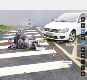
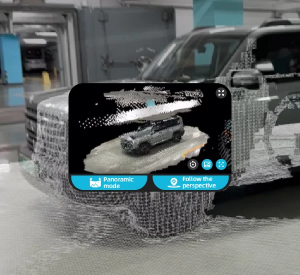
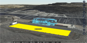
Traditional GIS remains essential, but many projects now require a three-dimensional view of the physical environment. Photogrammetry and LiDAR can capture detailed information about terrain and built environments, while GNSS positioning can provide the georeferencing needed for spatially accurate models. A 3D scene adds height, shape, and structure to geographic information, making complex sites easier to inspect.
We see particular value when 3D reconstruction is connected to GIS and AI. Rather than relying only on manual imagery review, organizations can combine spatial geometry with automated detection and change analysis. This creates a workflow that moves from data acquisition to reconstruction and then to interpretation, rather than stopping at visualization.
AI and Geospatial Intelligence Solutions
The growing volume of imagery and geographic information makes automation increasingly important. AI can help identify objects, classify imagery, detect anomalies, and accelerate the review of large datasets. The National Geospatial-Intelligence Agency describes GEOINT as the exploitation and analysis of imagery and geospatial information to describe, assess, and visually depict physical features and geographically referenced activities.
For enterprises and public-sector teams, geospatial intelligence solutions can extend the use of GIS beyond mapping and visualization to support more informed decision-making. When AI is integrated with spatial data, analysts can spend less time searching through raw information and more time evaluating meaningful findings. Strong systems still require human oversight, reliable source data, and clear objectives.
Applying Spatial Analysis to Municipal Governance
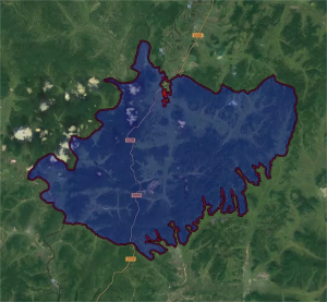
Municipal and natural-resource management provide a practical example. Urban surveying may involve roads, buildings, terrain, parcels, vegetation, and construction activity across large areas. Spatial analysis in geography can compare current observations with planning data, identify changes, and highlight locations that deserve field verification.
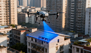
Illegal construction inspection is another relevant use case. Aerial imagery and high-precision 3D models can provide a current representation of buildings and surrounding land. Spatial analysis can then support comparisons between observed conditions and authorized information. The objective is not to replace regulatory procedures, but to make inspection more targeted and evidence-based.
Why Data Quality and Workflow Design Matter
Advanced tools cannot compensate for weak inputs. Coordinate reference systems, positional accuracy, acquisition conditions, temporal consistency, and metadata all affect analytical reliability. We recommend defining the decision objective first, then selecting suitable data, spatial scale, analytical methods, validation steps, and output formats.
An effective workflow should also consider how results will be used. A planning department may need maps and statistics, while an inspection team may need prioritized locations and 3D visual evidence. Designing outputs around user decisions keeps technical models connected to operations.
Our Approach to Visual Spatial Intelligence
At IceCypress Technology, we focus on spatial 3D reconstruction, AI, and drone swarm collaboration, building solutions across data acquisition, reconstruction, and intelligent applications. Our technology portfolio includes DroneSwarm for multi-UAV collaboration, Rusa for rapid 3D scene reconstruction, and Mirauge3D for urban-scale modeling. These capabilities support our broader geospatial intelligence solutions for applications where timely spatial understanding matters.
For municipal and natural-resource scenarios, our approach can connect aerial data collection with 3D modeling and AI-assisted analysis. This helps organizations build a more consistent digital representation of their operating environment and use spatial information for surveying, inspection, monitoring, and governance.
Turning Geographic Data Into Better Decisions
The future of spatial analysis is not simply about producing more maps. It is about connecting accurate geographic data with appropriate analytical methods, 3D context, automation, and clear operational objectives. Spatial analysis in geography provides the methodological foundation, while AI and modern sensing technologies expand what organizations can understand from each dataset. We believe integrated workflows can help public agencies and businesses move from fragmented geographic information toward faster, more informed spatial decisions.