Digital twins help organizations connect physical assets with digital models, geographic information, and operational data. However, different platforms approach this goal from different directions. Some emphasize geographic information systems (GIS), others focus on infrastructure engineering, while specialized technologies concentrate on capturing and interpreting real-world environments.
For businesses comparing digital twin solution providers, understanding these differences is more useful than simply comparing feature lists. At Icecypress Technology, we focus on 3D reconstruction, UAV mapping, and spatial AI. Comparing our approach with Esri and Bentley iTwin helps project teams identify which capabilities best match their operational requirements.
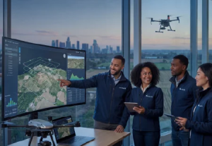
Three Different Approaches to Digital Twins
A digital twin is more than a three-dimensional model. Depending on the application, it may combine geometry, geographic context, engineering information, sensor data, and updates describing real-world conditions. The appropriate technology depends on which information an organization needs to collect, integrate, and use.
The following comparison draws on the companies’ published capabilities, rather than claiming that one platform is universally superior.
Icecypress Technology: Spatial Data Capture and AI Analysis
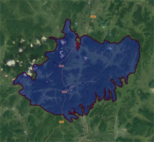
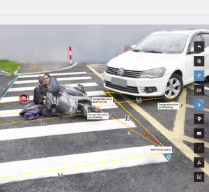
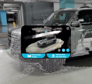
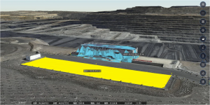
We focus on turning aerial imagery and spatial observations into usable geospatial information. Our workflow connects UAV data capture, photogrammetry, 3D reconstruction, and spatial AI analysis. Outputs include 3D meshes, point clouds, and orthomosaics, with analysis supporting object detection, change analysis, and structured data for GIS and operational systems. These capabilities are relevant when teams need detailed representations of physical environments.
Our approach is particularly relevant to surveying, infrastructure inspection, emergency response, and large-area mapping. For example, multiple UAVs can collaborate on photogrammetry missions, while onboard and cloud processing contribute to reconstruction workflows. Our Rusa, Mirauge3D, and DroneSwarm technologies address different aspects of 3D reconstruction and UAV-based spatial intelligence.
As a spatial intelligence AI company, we emphasize the stages between acquiring visual data and extracting meaningful spatial information. However, our capabilities should not be confused with a complete enterprise GIS or infrastructure asset management environment. Buyers should assess how our outputs fit their existing platforms, data standards, and operational processes.
Esri: GIS, Geographic Context, and Spatial Analysis
Esri approaches digital twins through geographic information systems. Its ArcGIS ecosystem combines maps, spatial analysis, 3D visualization, and information from sources such as business systems, sensors, and information models. This makes it suitable for organizations that need to understand assets within their wider geographic and operational context.
For municipalities, utilities, environmental teams, and regional planners, geographic relationships may matter as much as the geometry of individual assets. A digital twin can connect buildings, transportation networks, environmental conditions, and public services within a shared spatial framework.
Compared with our specialized focus on visual reconstruction and spatial AI, Esri is a natural candidate when GIS data management and geographic analysis form the center of a project. The two approaches can also complement each other: UAV-derived models and extracted spatial information may provide useful inputs to a broader GIS workflow, subject to format compatibility and integration requirements.
Bentley iTwin: Infrastructure Engineering and Lifecycle Data
Bentley’s iTwin Platform focuses on creating infrastructure digital twin applications. Its APIs and services connect engineering and design information with reality data, IoT data, and other project information. The platform also supports visualization, change tracking, data management, and application development.
This approach is especially relevant to engineering firms, infrastructure owners, construction teams, and software developers working on roads, railways, utilities, and industrial facilities. Rather than treating a 3D model as an isolated deliverable, iTwin provides a framework for connecting different data sources across infrastructure projects.
Bentley also offers reality data capabilities for working with photographs, point clouds, and meshes. Therefore, it would be inaccurate to characterize iTwin as lacking reality capture or spatial analysis. The distinction lies more in overall emphasis: we specialize in visual spatial intelligence workflows, while iTwin provides a broader infrastructure-oriented platform for integrating and using project information.
How Should Businesses Compare These Providers?
When evaluating digital twin solution providers, buyers should begin with their primary business problem rather than the number of available features.
Choose a spatial reconstruction-focused approach when acquiring aerial data, building detailed 3D representations, and extracting information from visual scenes are central requirements.Consider Esri when geographic information, spatial analysis, mapping, and relationships between assets and surrounding environments dominate the workflow.Consider Bentley iTwin when engineering data, infrastructure project coordination, and asset information across the lifecycle are key priorities.
These categories are not mutually exclusive. A project may use specialized reconstruction technology to create spatial data, GIS to analyze geographic relationships, and an infrastructure platform to connect models with engineering records. Integration effort, licensing, data ownership, and staff expertise should all form part of the evaluation.
For procurement teams comparing digital twin solution providers, practical testing is more informative than broad marketing claims. Ask each vendor to demonstrate a representative dataset, document supported input and output formats, measure processing time under realistic conditions, and explain how updates and data access are managed.
A spatial intelligence AI company should also be assessed on the specific analytical tasks it supports, the quality of its outputs, and the deployment environment required. These checks help buyers distinguish proven capabilities from features that may require additional development or third-party tools.
Building the Right Digital Twin Strategy
Icecypress Technology, Esri, and Bentley iTwin address related but different parts of the digital twin landscape. We focus on UAV mapping, 3D reconstruction, and spatial AI; Esri centers its offering on GIS and geographic analysis; Bentley iTwin emphasizes infrastructure data integration and engineering workflows.
The right choice depends on the data an organization starts with, the decisions it needs to support, and the systems it already uses. At Icecypress Technology, we help customers transform visual and spatial data into structured information for professional geospatial applications. By assessing each provider against real project requirements, businesses can build a digital twin workflow that balances technical capability, integration needs, and long-term operational value.