- HOME
- ABOUT US
- PRODUCTS
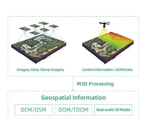
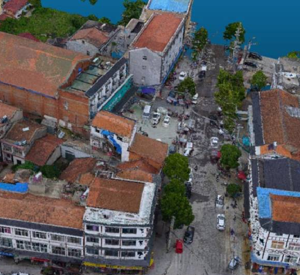
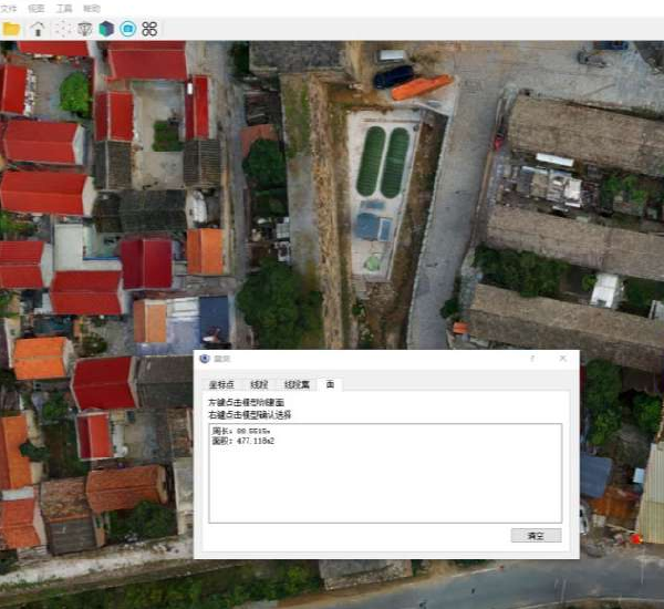
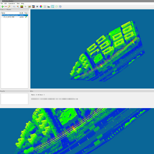
- Mirauge3D Fully Automatic Image 3D Modeling System
- Rusa Fast 3D Scene High-Precision Reconstruction System
- TrackSight High-Speed Target Tracking & Analytics System
- DroneSwarm Real-Time Online Analytics System
- BeeSmart Drone Swarm: Hardware-Software Integrated Total-Domain Intelligent Operation Solution
- Hunter Wing – Single-Operator UAV Mapping & Recognition System
- SOLUTION
- RESOURCE
- CONTACT US